本预览的尺寸:800 × 507像素。 其他分辨率:2,824 × 1,789像素。
原始文件 (2,824 × 1,789像素,文件大小:1.09 MB,MIME类型:image/jpeg)
摘要
| 描述 |
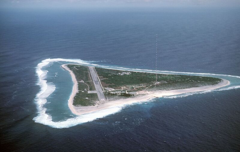
English: Aerial view of Minamitori Island (Minami-Torishima), Japan. There is a runway which supported the US Coast Guard station located there prior to 1993. Minamitori Island is the easternmost island of the Japanese archipelago.
Deutsch: Luftaufnahme der Minamitori Insel (Minami-Torishima), Japan.
日本语: 南鳥島の空中写真。 |
| 日期 | 1987-06-18 |
| 来源 |
|
| 作者 | Chief Master Sergeant Don Sutherland, U.S. Air Force |
许可协议
本作品是由美国联邦政府的官员或雇员基于其个人公务目的制作;根据美国法典第17篇第1章第105条(17 U.S. Code § 105),本作品在美国属于公有领域。
请注意:本模板仅适用于美国联邦政府的原创作品,不适用于任何美国州、属地、联邦个体、县、市或任何次级政府的作品。本模板也不适用于1978年以后由美国邮政署出版的邮票图案(参看美国版权局实践纲领第313.6(C)(1)条);本模板也不适用于部分美国硬币,参见美国铸币局使用条款。

文件历史
点击某个日期/时间查看对应时刻的文件。
| 日期/时间 | 缩略图 | 大小 | 用户 | 备注 | |
|---|---|---|---|---|---|
| 当前 | 2023年12月17日 (日) 12:21 |  | 2,824 × 1,789(1.09 MB) | BXHS-bot(留言 | 贡献) | 自其他网站迁移文件 |
您不可以覆盖此文件。