本预览的尺寸:600 × 600像素。 其他分辨率:700 × 700像素。
原始文件 (700 × 700像素,文件大小:159 KB,MIME类型:image/png)
摘要
| 描述 |
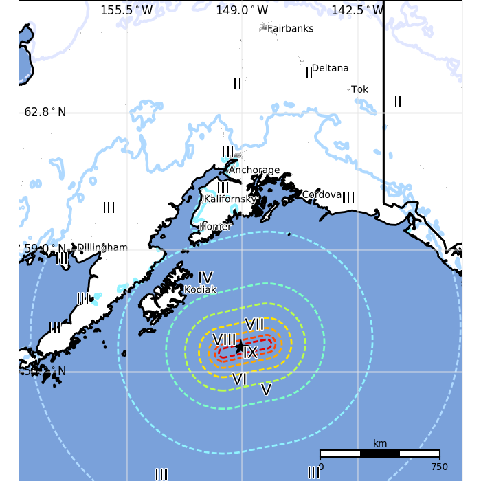
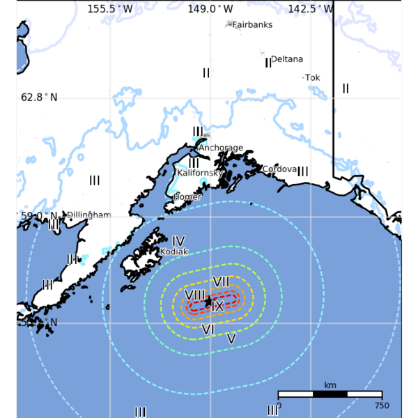
Deutsch: Das Seismogramm des Alaska Erdbebens im Jahr 2018 vom US Geological Survey.
English: Isoseismal map of the Alaska Earthquake in 2018 provided by the US Geological Survey.
中文(简体):美国地质调查局提供的2018年阿拉斯加地震等震线图。 |
| 日期 | 2018-01-24 |
| 来源 | https://earthquake.usgs.gov/realtime/product/losspager/us2000cmy3/us/1516834585629/exposure.png |
| 作者 | USGS |
许可协议
本作品是由美国联邦政府的官员或雇员基于其个人公务目的制作;根据美国法典第17篇第1章第105条(17 U.S. Code § 105),本作品在美国属于公有领域。
请注意:本模板仅适用于美国联邦政府的原创作品,不适用于任何美国州、属地、联邦个体、县、市或任何次级政府的作品。本模板也不适用于1978年以后由美国邮政署出版的邮票图案(参看美国版权局实践纲领第313.6(C)(1)条);本模板也不适用于部分美国硬币,参见美国铸币局使用条款。

文件历史
点击某个日期/时间查看对应时刻的文件。
| 日期/时间 | 缩略图 | 大小 | 用户 | 备注 | |
|---|---|---|---|---|---|
| 当前 | 2023年12月5日 (二) 12:44 | | 700 × 700(159 KB) | BXHS-bot(留言 | 贡献) | 自其他网站迁移文件 |
您不可以覆盖此文件。